Trail Walking Le Val-d'Ajol - circuit chalet de l'empereur - la vigotte - Photo

circuit chalet de l'empereur - la vigotte

© OpenStreetMap contributors
Length
Length
11.5 km
Max alt
Max alt
744 m
Uphill gradient
Uphill gradient
314 m
Km-Effort
Km-Effort  
15.7 km
Min alt
Min alt
483 m
Downhill gradient
Downhill gradient
314 m
Boucle
Boucle
Yes
Creation date :
2024-05-14 09:06:11.182
Updated on :
2024-05-14 12:04:47.144

(0 Reviews)

Walking
Walking
2h58
Difficulty : Difficult

Scan this QR Code to open this trail in the SityTrail application

FREE GPS app for hiking

Logo SityTrail SityTrail

IGN / Geographical institutes

Download SityTrail from the App Store Download SityTrail from Google Play

Logo SityTrail SityTrail World

The world is yours!

Download SityTrail from the App Store Download SityTrail from Google Play Download SityTrail on Huawei AppGallery

About

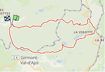
Trail Walking of 11.5 km to be discovered at Grand Est, Vosges, Le Val-d'Ajol. This trail is proposed by Emmanuel Remy.

Elevation profile

Photos

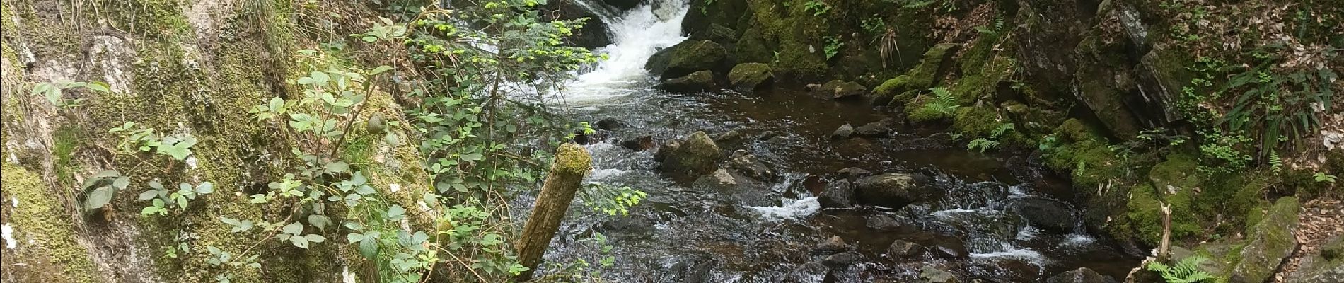
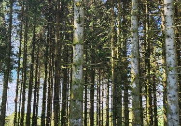
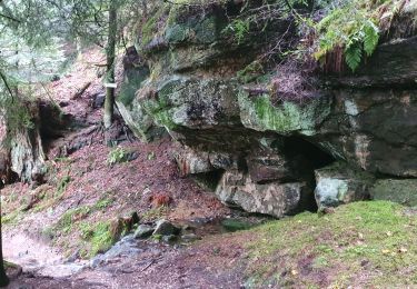
21 photos in total. Please click on a photo to see them all in the gallery.

Positioning

Country:
France
Region :
Grand Est
Department/Province :
Vosges
Municipality :
Le Val-d'Ajol
Location:
Unknown
Start:(UTM)
317281 ; 5315762 (32T) N.

Trails nearby

Trail On foot Girmont-Val-d'Ajol - Les Étangs du Girmont - Photo
On foot
PRO

On foot

Easy
Girmont-Val-d'Ajol, Grand Est, Vosges, France
9.9 km | 13.1 km-effort
2h 59min
Yes
Trail Mountain bike Girmont-Val-d'Ajol - Rando de Che No 2013 - Photo
Mountain bike
osidarta

Mountain bike

Difficult
(1)
Girmont-Val-d'Ajol, Grand Est, Vosges, France
48 km | 63 km-effort
3h 59min
Yes
Trail Walking La Montagne - la montagne 70000  - Photo
Walking
francislassauce

Walking

Very difficult
La Montagne, Bourgogne-Franche-Comté, Haute-Saône, France
17.2 km | 23 km-effort
5h 3min
No
Trail Walking Girmont-Val-d'Ajol - GIRMONT VAL D'AJOL - Photo
Walking
ISATR

Walking

Difficult
(1)
Girmont-Val-d'Ajol, Grand Est, Vosges, France
9.3 km | 12.9 km-effort
2h 55min
Yes
Trail On foot Girmont-Val-d'Ajol - La Beuille, sur la ligne de partage des eaux - Photo
On foot
PRO

On foot

Easy
(1)
Girmont-Val-d'Ajol, Grand Est, Vosges, France
8.7 km | 12.1 km-effort
2h 45min
Yes
Trail Walking Saint-Étienne-lès-Remiremont - Le sentier des Pourdingues - Photo
Walking
viam19

Walking

Easy
Saint-Étienne-lès-Remiremont, Grand Est, Vosges, France
10.7 km | 15.3 km-effort
2h 25min
Yes
Trail Walking Remiremont - Remiremont - baraque des gardes - étang du Villerain - cascade du Géhart - étangs et prieuré d'Hérival  - Photo
Walking
Bart2015

Walking

Medium
Remiremont, Grand Est, Vosges, France
16.6 km | 23 km-effort
5h 19min
Yes
Trail Walking Girmont-Val-d'Ajol - 24-02-19 girmont - Photo
Walking
annefrance70

Walking

Medium
Girmont-Val-d'Ajol, Grand Est, Vosges, France
10.8 km | 15.4 km-effort
2h 35min
Yes
Trail Snowshoes La Montagne - raquettes st bresson 14-01-17 - Photo
Snowshoes
annefrance70

Snowshoes

Easy
La Montagne, Bourgogne-Franche-Comté, Haute-Saône, France
4.6 km | 5.9 km-effort
1h 36min
Yes


Close
My subscriptions